Iceland Study Trip October 2013
Don't forget the Discover the World Study Trips Photo & Video Competition 2013
Photos can be anything from students and teachers having a great time, through to captivating pictures of spectacular scenery - better still a combination of both will help make your entry really stand out! Videos should be diary highlights of your trip, but above all else, we are looking for fun, inspiring and entertaining videos and photographs so let your imagination run riot!
Please submit your entries by 4 January 2014. The winners will be announced the following week. We may however display content on our website and other marketing material beforehand. By entering this competition you agree to the aforementioned. More information and previous examples are available on the Discover the World website link here.
Please submit your entries by 4 January 2014. The winners will be announced the following week. We may however display content on our website and other marketing material beforehand. By entering this competition you agree to the aforementioned. More information and previous examples are available on the Discover the World website link here.
This picture of Reynishverti was taken by Ellie Wolfe
lick here to edit.
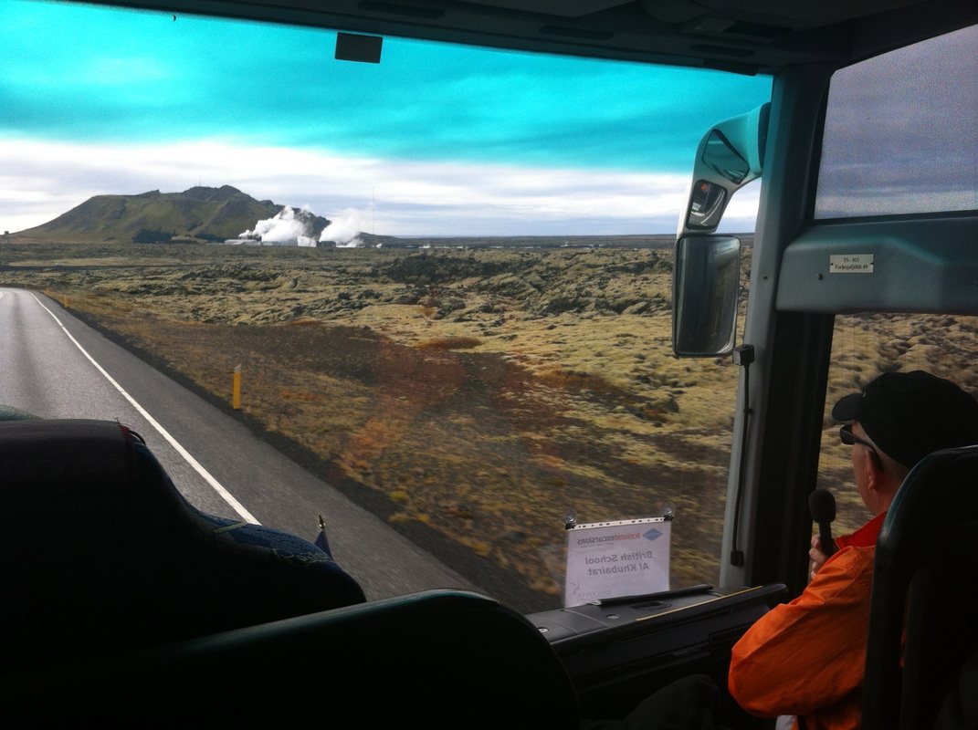
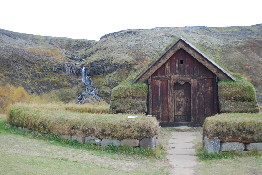
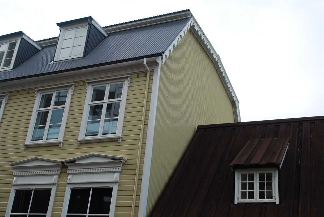
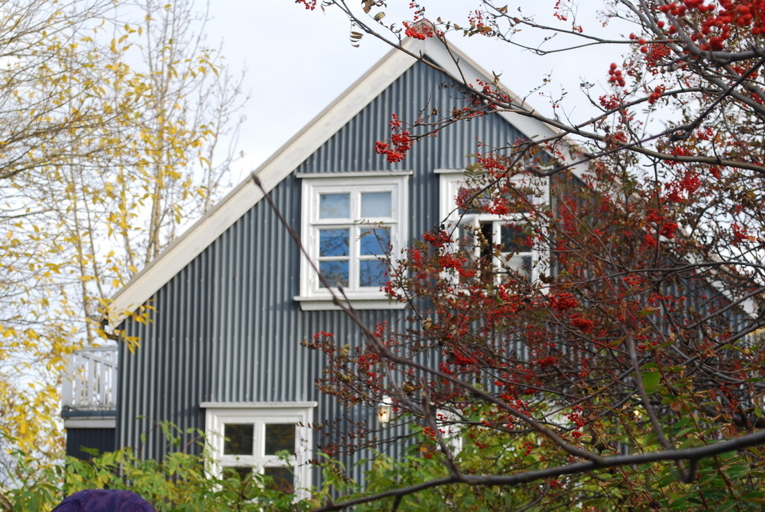
Saturday 5 October 2013
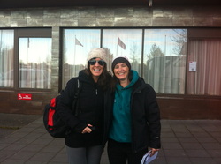
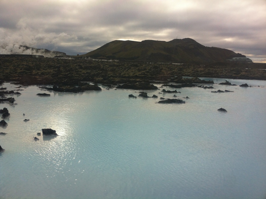
Mrs Rawlings Smith and Miss Willis outside Hotel Hafnarfjordur on our way to the Blue Lagoon.
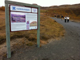
Blue Lagoon is the most visited destination in Iceland. It was formed by accident in 1976, by the Suournes Regional Heating Corporation, who were deep drilling and searching for a reliable geothermal source. Waste water was meant to flow back underground, but the high silica content of the water created an impermeable surface layer and a new surface reservoir was formed. Blue lagoon has attracted swimmers since the early 1980s, the spa was only officially opened in 1999.
Blue Lagoon is the most visited destination in Iceland. It was formed by accident in 1976, by the Suournes Regional Heating Corporation, who were deep drilling and searching for a reliable geothermal source. Waste water was meant to flow back underground, but the high silica content of the water created an impermeable surface layer and a new surface reservoir was formed. Blue lagoon has attracted swimmers since the early 1980s, the spa was only officially opened in 1999.
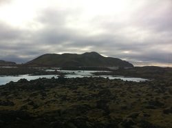
Some of the blue waters in the Svartsengi area. The waters are silica-rich and are coloured blu by the blue-green algae found in the water. Svartsengi is one of the largest geothermal energy plants in the world.
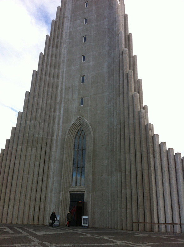
The photographs below show Hallgrimskirkja Church and the statue of Leifr Eiricsson.
Perlan, one of the three locations where warm water storage occurs in Iceland. It is the highest point in the capital and allows for water to travel downhill to homes.Three tanks house warm water, two contain return water and one is a museum.

|
|
|
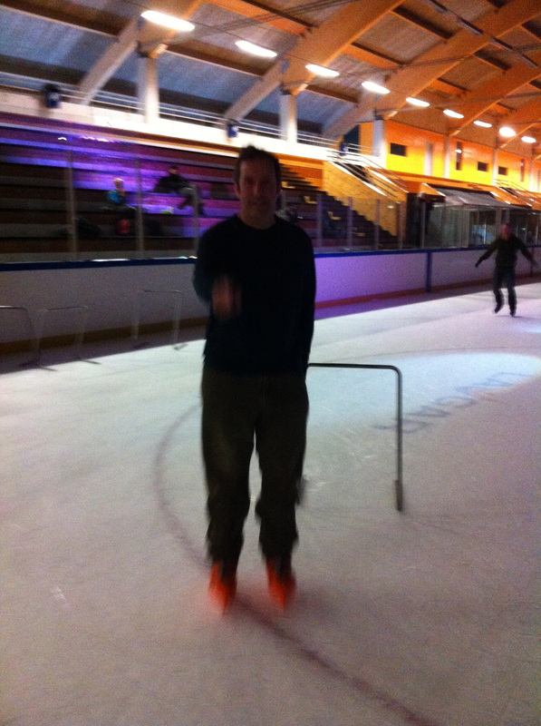
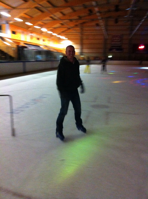
Mr Blan and Mr Lydall showing us their ice skating skills - blurred feet indicate the speed of travel!
|
|
|
|
|
Sunday 6 October 2013
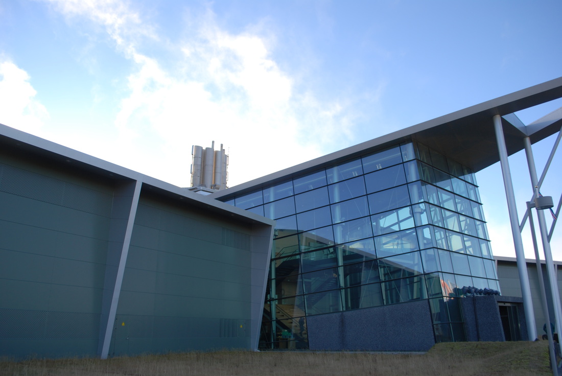
We started the day at Hellisheidi Geothermal power station, where we saw how the buildings of Iceland are heated and water is heated. Within the south-west of Iceland there are four fissure swarms which are known as high temperature areas and have enough energy that water can be piped into the hot rock to produce steam, driving turbines ready to generate electricity.
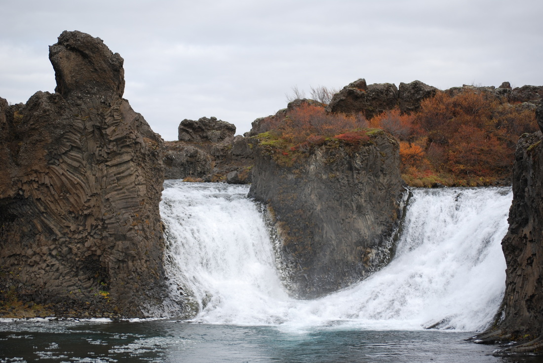
Our first waterfall of the day was Hjálparfoss, situated in the Vikrar lava fields north of Hekla. Even though it was really cold here, students explored the double waterfall, surrounded by basalt columns.
After driving past wind turbines, east from Hellisheidi, we stopped at a pumice quarry at the foot of Mt Hekla, a volcano known locally as the gateway to hell after the massive eruption of 1104, when 12 metres of pumice and ash covered the surrounding farms and houses and killed livestock with poisonous gases. Hekla means cloak or hood and this refers to the clouds which cover the volcano, clear days perhaps only occurring for 18 days a year.
Hekla has erupted five times in the last century and is therefore the most active volcano in Iceland today. Only 30 minutes warning can be given prior to an eruption and most of these are explosive, noisy and cause a great deal of devastation for the surrounding land. Hekla means cloak or hood and this refers to the clouds which cover the volcano, clear days perhaps only occurring for 18 days a year. Mt Hekla is overdue for an eruption, however, the eruption from nearby Eyjafjallajokull in 2010 may have delayed it.
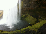
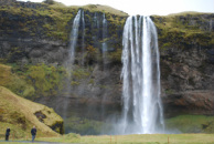
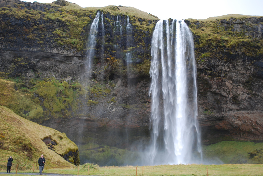
Seljalandsfoss and Skogafoss waterfalls were the last two stops of the day and they did not disappoint! We walked behind Seljalandsfoss and the hydraulic force of the water was amazing, the thundering water carving out a deep plunge pool and creating a great deal of spray in the process. This waterfall spilling over a basalt cliff, falling over 60 metres and showing just how much the land has risen since the last ice age due to the isostatic rebound.
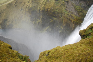
Skogafoss was another impressive waterfall at 60 metres. Students and teachers ran up to the observation deck above the falls to see the falls from a different perspective.
|
|
|
Monday 7 October 2013
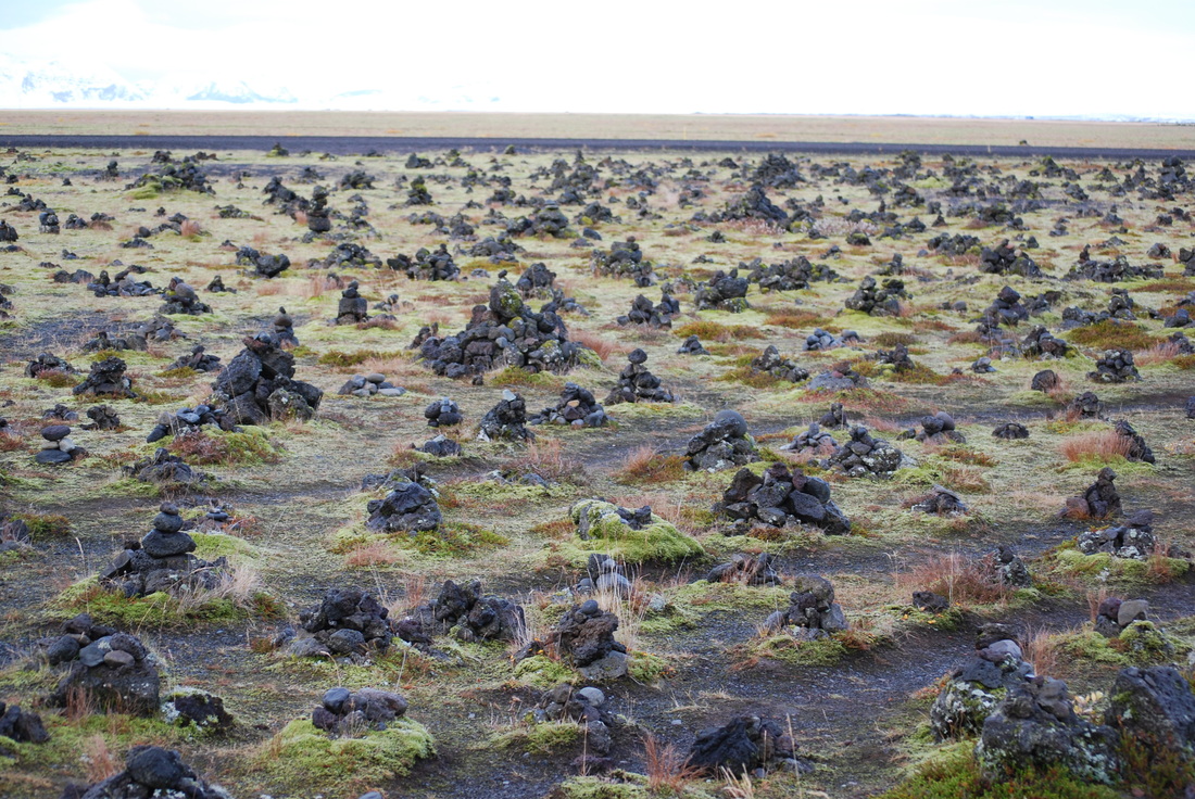
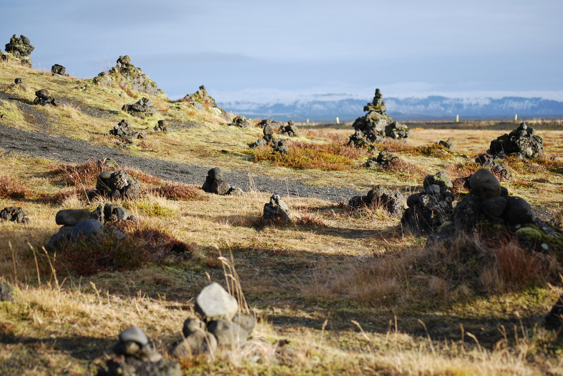
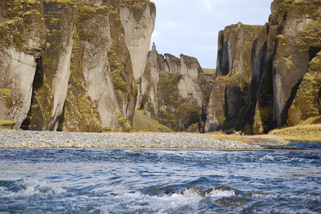
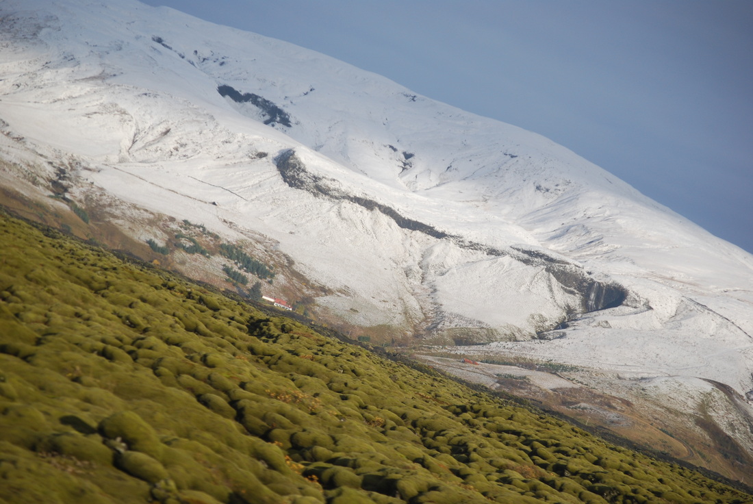
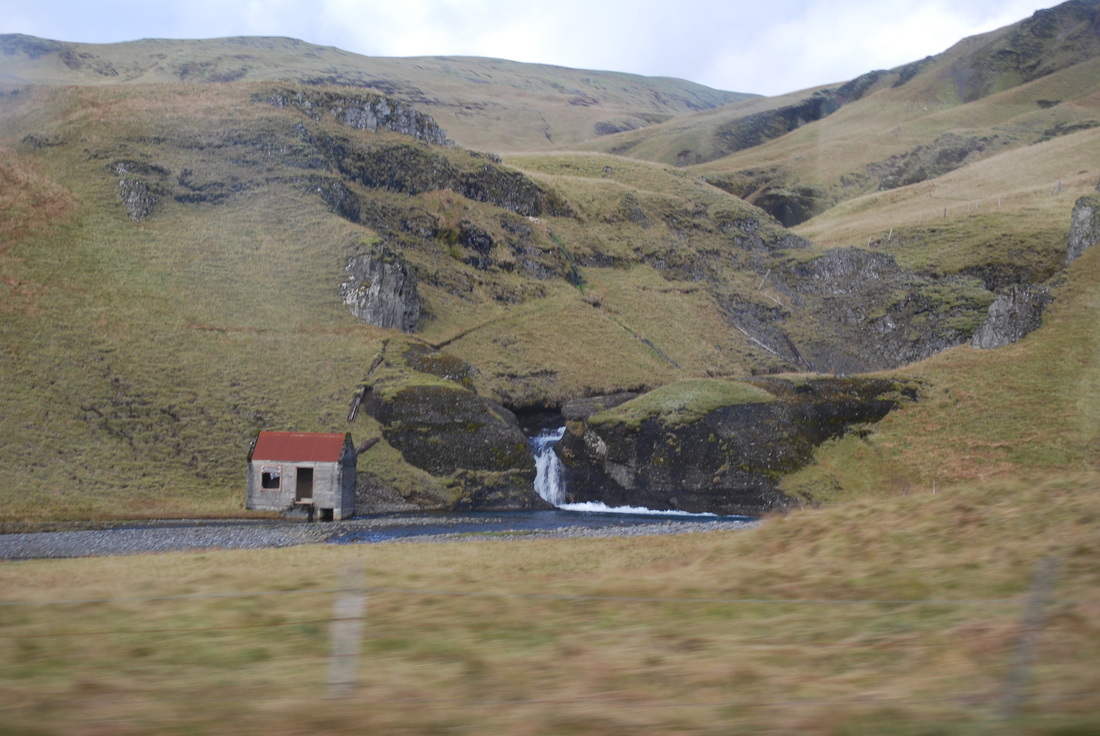
After having another filling breakfast, we made our way to Eldhraun, the lava flow from the 1783 eruption of Laki. Cairns (piles of rock) were built or added to as a right of passage to the east of the country. The extensive, 560 square kilometer lava flow, is thought to be the largest ever from a single eruption and is now covered in moss, in places 30cm deep. Students bounced between the lava peaks and pillows of moss before we moved onto Fjadargljufur, a 100 metre canyon, formed over two million years ago.
|
|
|
|
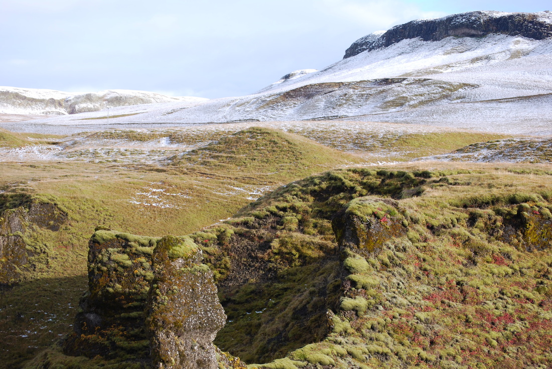
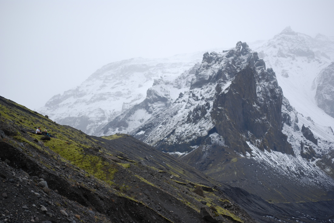
All the students walked quickly along the two kilometre canyon rim, looking deep down to the river. In places the hyaloclastite rock seemed very steep and the bottom of the canyon seemed very far away. If I knew that the rock I was standing on was soft, granular rock, I might not have stood quite so close to the edge. The snow covered hillside not only showed off how soil creep formed terracettes, but it also gave opportunity for a few snowballs to be thrown. The warm, sunny autumn weather allowed us to remove the multiple layers of warm weather gear and enjoy the best of the spectacular scenery.
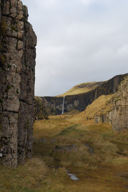
Once we had travelled along the coastal road we made a quick stop at the ‘Dwarf Cliffs’ of Dverghamrar. The basalt colums in this small gorge were the perfect size for climbing on. The columns were formed as lava flowed into a small basin and cooled rapidly as water washed over the top of them.
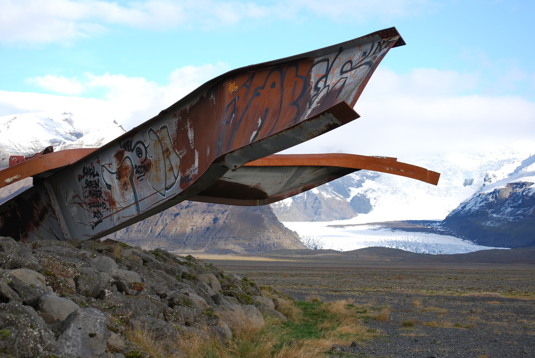
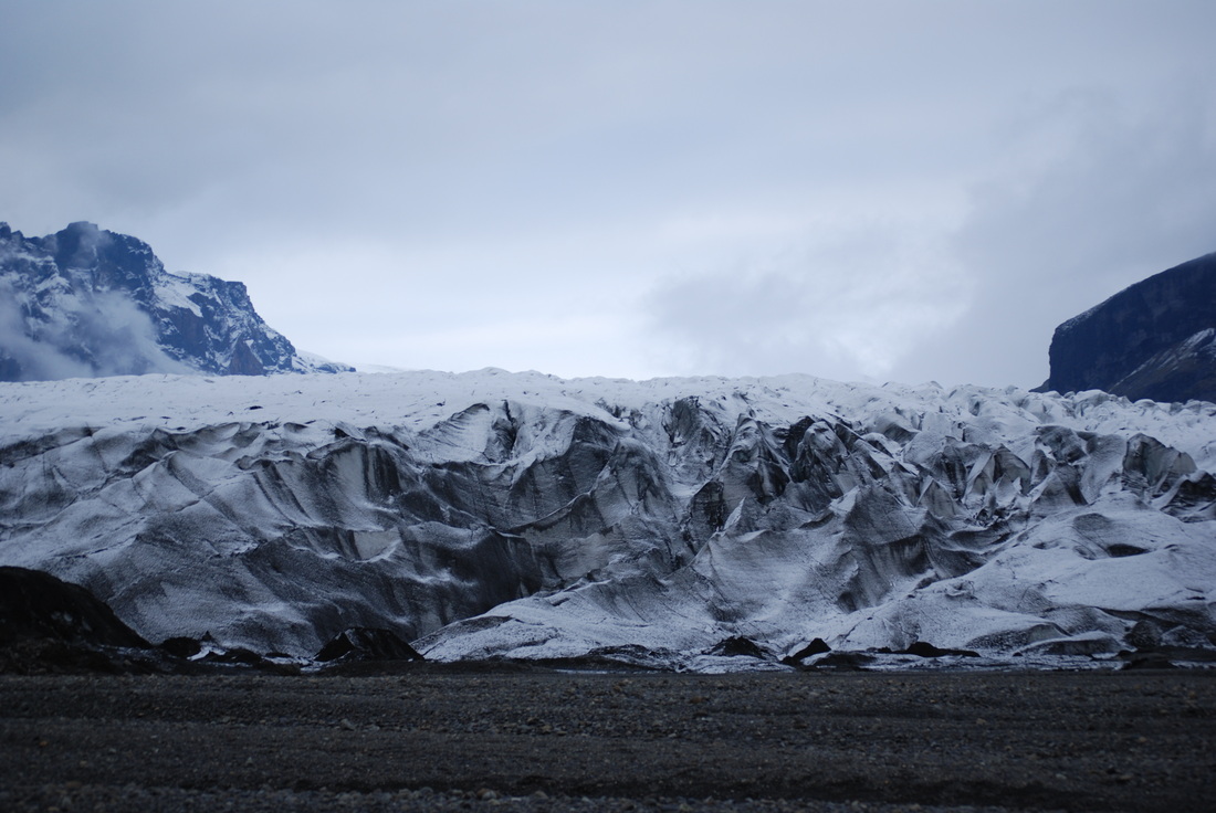
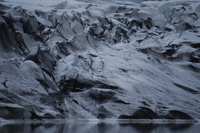
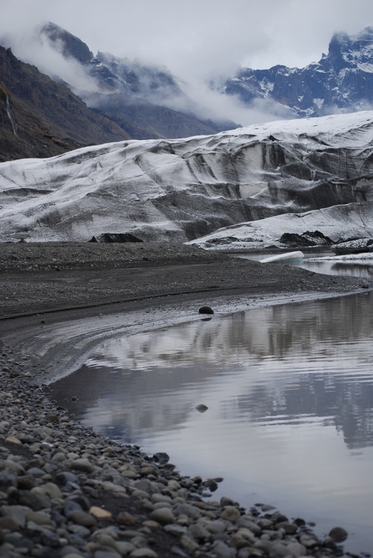
After watching a short film about the glacial burst or jokulhlaup of 1991 in the Skaftafell National Park visitor centre, we walked two kilometres to the snout of the Skeidararjokull outlet glacier that feeds off Vatnajokull. The landscape was truly awe inspiring and students could get up close to look at the glacial moraine, sediments deposited as the glacier retreats up the valley. If we had taken this walk in 1950 we would only have needed to walk 500 metres form the visitor centre as modern global climate change has made a huge impact on the rate of recession over the last few years.
Once we had travelled along the coastal road we made a quick stop at the ‘Dwarf Cliffs’ of Dverghamrar. The basalt colums in this small gorge were the perfect size for climbing on. The columns were formed as lava flowed into a small basin and cooled rapidly as water washed over the top of them.
After watching a short film about the glacial burst or jokulhlaup of 1991 in the Skaftafell National Park visitor centre, we walked two kilometres to the snout of the Skeidararjokull outlet glacier that feeds off Vatnajokull. The landscape was truly awe inspiring and students could get up close to look at the glacial moraine, sediments deposited as the glacier retreats up the valley. If we had taken this walk in 1950 we would only have needed to walk 500 metres form the visitor centre as modern global climate change has made a huge impact on the rate of recession over the last few years.
|
|
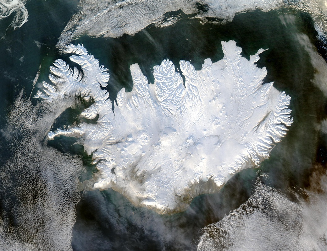
Satellite image of Iceland - note the lack of ice in the south-west Available online here (Jeff Schmaltz NASA in public domain)
Tuesday 8 October 2013
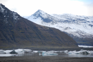
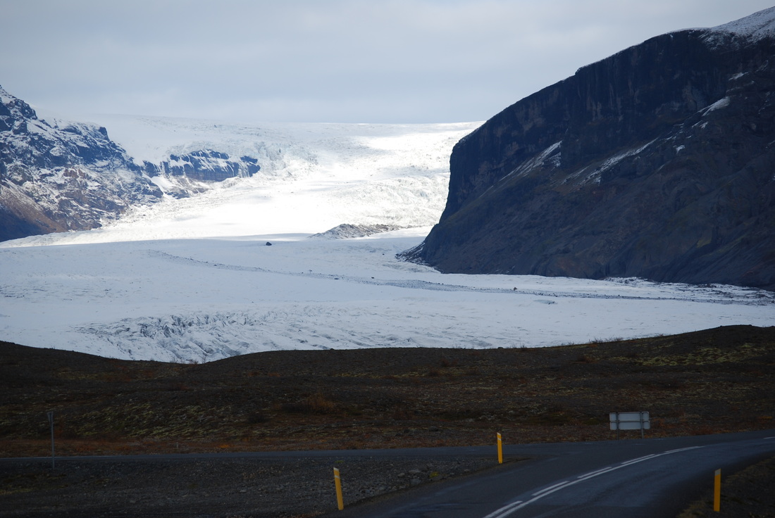
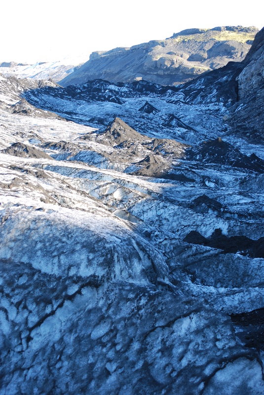
Today we were not racing from one location to the next. Our first destination was Kviarjokull, a valley glacier with huge arcuate moraines (piles of rock deposited by the glacier as it melts and retreats up the valley). Glaciers are melting here, just like they are across the globe because the temperature is warming. This means the rate of melting of the end or snout of the glacier is faster than the rate of snow accumulation higher up in the mountains. It is quite likely that these small valley glaciers will have all disappeared in Iceland by the middle of the next century. Vatnajokull with an area of 8, 000 km² is the second largest glacier in Europe by area, covering eight per cent of Iceland. Vatnajokull is unlikely to fully melt due to climate change because it is located at high elevation where the temperature is cool. Under the ice cap there are several volcanoes and volcanic lakes. In 1996 it was Grimsvotn which ws responsible for the huge glacial outburst which caused huge floods to flow down to the sea, destroying bridges in its path. Most bridges are only built to withstand 10, 000 cumecs of water, in 1996 the flow rate was more like 50, 000 cumecs. Walking along the moraines of Kviarjokull gave us the opportunity to see the different size of glacial material which had been dumped by the ice.
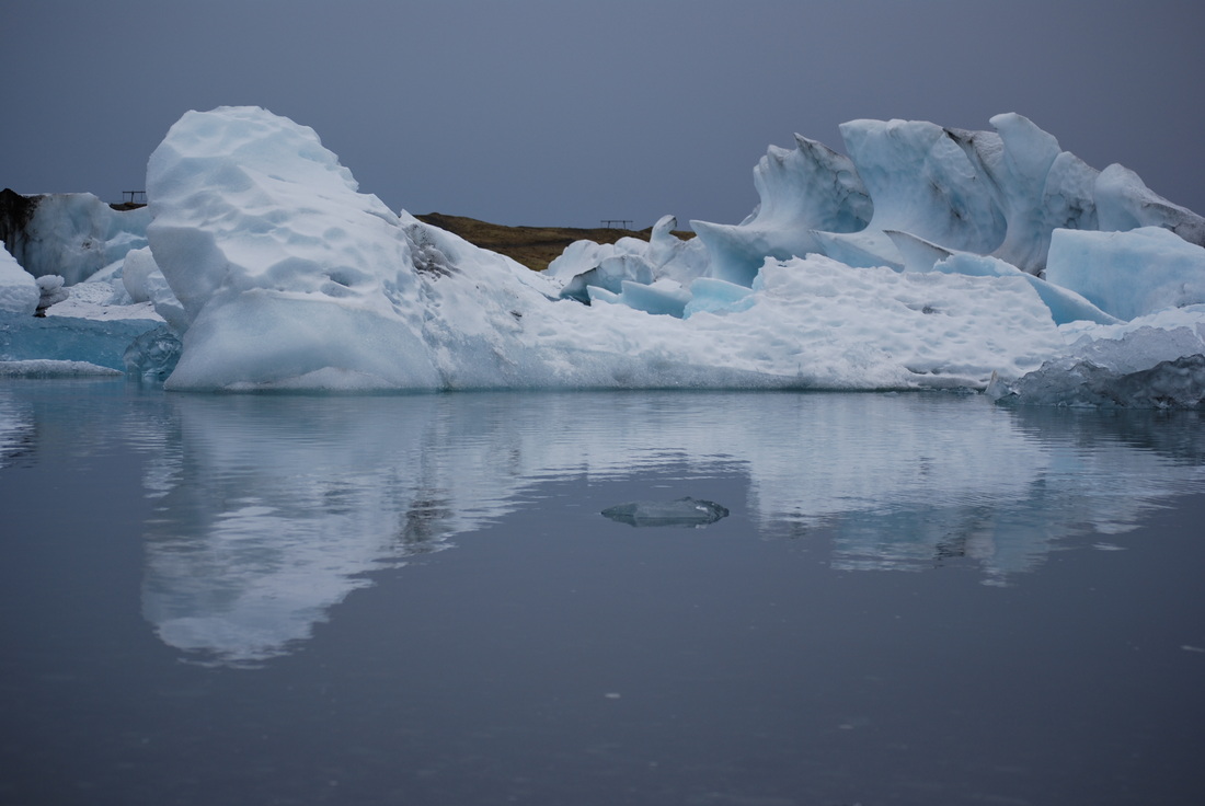
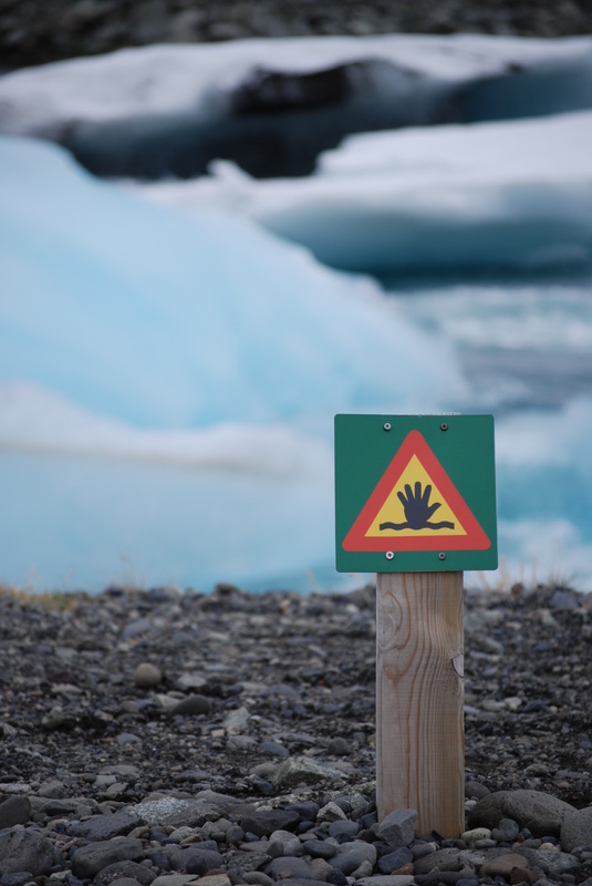
As we boarded the bus to travel to Jokulsarlon, the weather quickly changed. The snow that was now falling rapidly transformed the landscape from black mountains to white and the temperature also dropped. When we arrived at Jokulsarlon, we watched icebergs rolling and knocking into each other as they made their way to the sea. Following this route, we walked down to the beach to see the contrast between 1,000 year old icebergs up close and the black sands of the beach. Walking back inland we followed the edge of the lagoon, seeing seals and more amazingly sculpted icebergs, some black with sediment, others reflective blue and white.
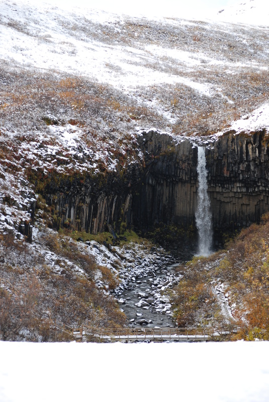
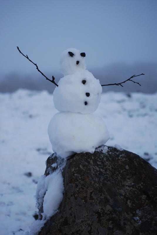
Our last destination of the day was Svartifoss, a waterfall dropping over some magnificent basalt columns. These large basalt columns develop as deep flows of molten rock flow into a dip or depression and slow,, they then shrink as they cool slowly. From a snow covered vantage point above the falls students built snowmen and threw snowballs at each other, it was for some an experience they had not had for several years.
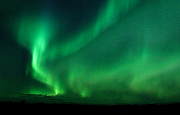
Once we were back at FossHotel the skies cleared and at last we caught glimpses of the Northern Lights, a natural light display formed at high latitudes when charged particles originating in the magnetosphere collide with each other and are directed by the magnetic field into the atmosphere - a great end to the day!
As we boarded the bus to travel to Jokulsarlon, the weather quickly changed. The snow that was now falling rapidly transformed the landscape from black mountains to white and the temperature also dropped. When we arrived at Jokulsarlon, we watched icebergs rolling and knocking into each other as they made their way to the sea. Following this route, we walked down to the beach to see the contrast between 1,000 year old icebergs up close and the black sands of the beach. Walking back inland we followed the edge of the lagoon, seeing seals and more amazingly sculpted icebergs, some black with sediment, others reflective blue and white.
Our last destination of the day was Svartifoss, a waterfall dropping over some magnificent basalt columns. These large basalt columns develop as deep flows of molten rock flow into a dip or depression and slow,, they then shrink as they cool slowly. From a snow covered vantage point above the falls students built snowmen and threw snowballs at each other, it was for some an experience they had not had for several years.
Once we were back at FossHotel the skies cleared and at last we caught glimpses of the Northern Lights, a natural light display formed at high latitudes when charged particles originating in the magnetosphere collide with each other and are directed by the magnetic field into the atmosphere - a great end to the day!

|
|
Image: Joshua Strang US military in public domain link here
Wednesday 9 October 2013
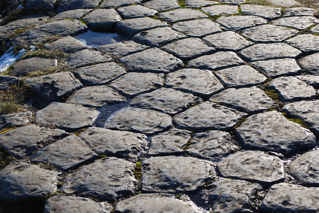
The weather today was much brighter and drier than yesterday, although the wind was a little bracing as we headed out to Kirkjugolf. Students stood on the smooth polished surface of basalt columns formed firstly by cooling lava shrinking into hexagonal shapes then by the glaciers which cut through the landscape eroding the top layer of lava.
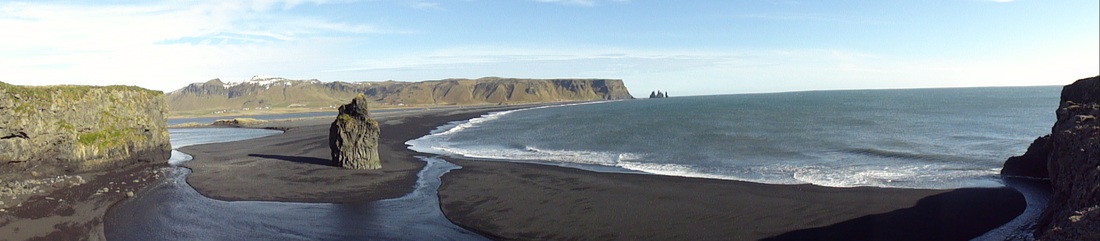
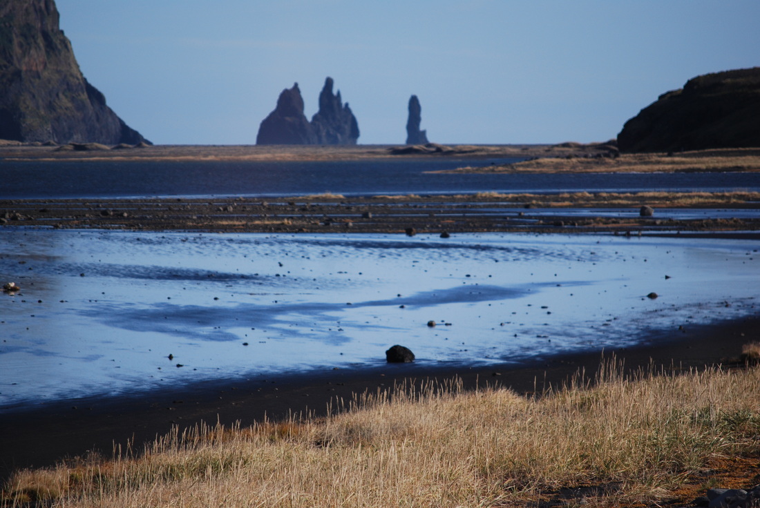
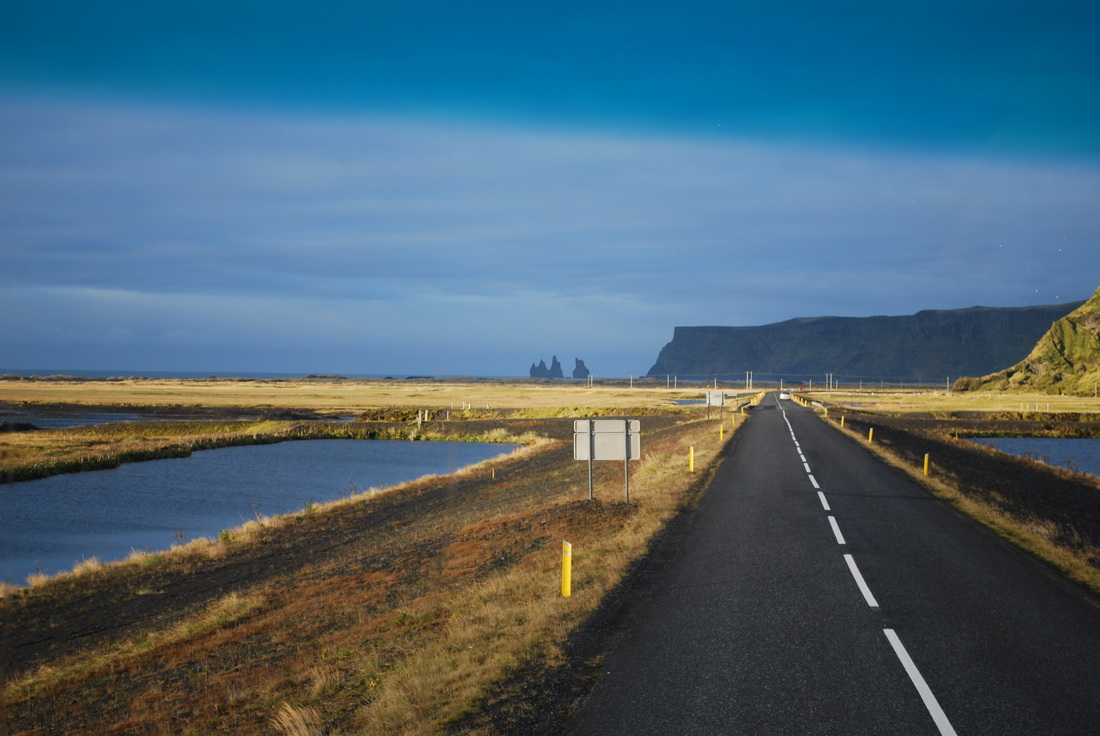
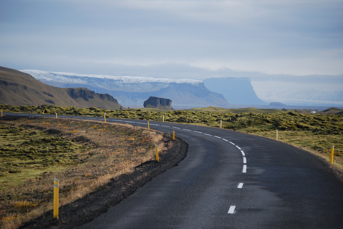
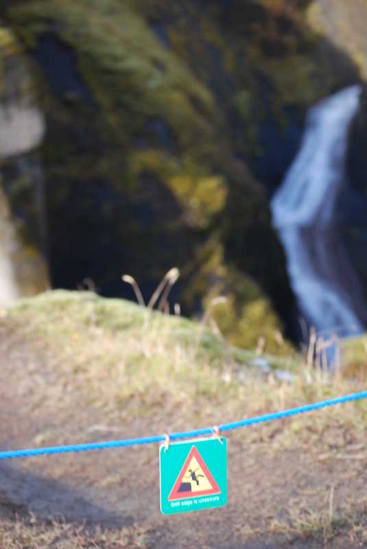
Further down the coastal road, we stopped at Reynishverti to see the basalt sea stacks and black sands, much of which was packed into bottles and taken away, possibly making suitcases a little heavier for the journey home. Just round the corner we came across Dyrholaey translated as 'door hill island', a prominent headland with a 120 metre high natural rock arch which students climbed and explored, before in some cases rolling back down the grassy verge back to the coach.
Our last glacier of the trip was next on the itinerary and Solheimajokull did not disappoint. The walk up to the glacier was short and we were able to clearly see the ice melting and leaving huge piles of moraine across the valley. Solheimajkull meaning 'sun house glacier' is one of the outlet glaciers from the Myrdalsjokull ice cap which covers Katla - one of Iceland's most active volcanoes. The glacier has been retreating since the end of the nineteenth century by around 100 metres a year, a rate of glacial retreat which seems phenomenal.
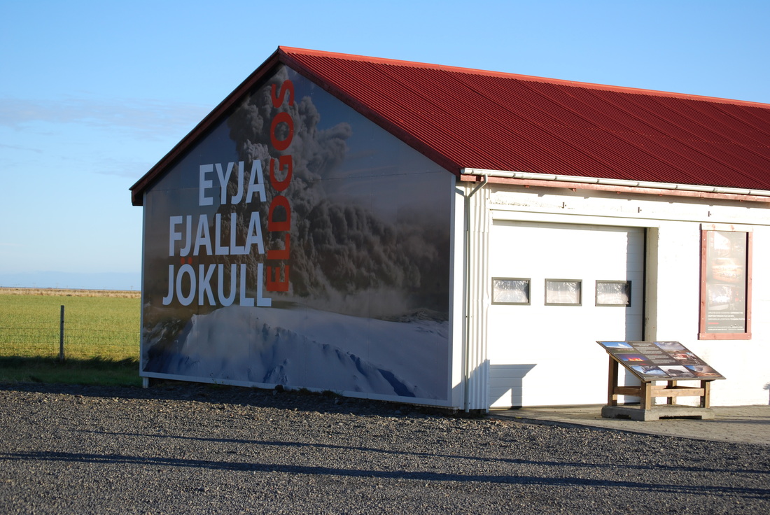
The last stop of the day was to the newly developed Eyjafjallajokull visitor centre, which is actually an old garage on one of the farms affected by the Easter 2010 eruption which grounded so many flights across Europe. Students watched an interesting film about the eruption and the impact on the local people. It was interesting to see that although the local livestock were affected by the ash, the farmers wanted to carry on with life even when the ash was still falling. Our accommodation for the night was not quite what the students were expecting. Farm Vatnsholt is an isolated farm with views of Hekla as well as excellent food and table tennis.
Further down the coastal road, we stopped at Reynishverti to see the basalt sea stacks and black sands, much of which was packed into bottles and taken away, possibly making suitcases a little heavier for the journey home. Just round the corner we came across Dyrholaey translated as 'door hill island', a prominent headland with a 120 metre high natural rock arch which students climbed and explored, before in some cases rolling back down the grassy verge back to the coach.
Our last glacier of the trip was next on the itinerary and Solheimajokull did not disappoint. The walk up to the glacier was short and we were able to clearly see the ice melting and leaving huge piles of moraine across the valley. Solheimajkull meaning 'sun house glacier' is one of the outlet glaciers from the Myrdalsjokull ice cap which covers Katla - one of Iceland's most active volcanoes. The glacier has been retreating since the end of the nineteenth century by around 100 metres a year, a rate of glacial retreat which seems phenomenal.
The last stop of the day was to the newly developed Eyjafjallajokull visitor centre, which is actually an old garage on one of the farms affected by the Easter 2010 eruption which grounded so many flights across Europe. Students watched an interesting film about the eruption and the impact on the local people. It was interesting to see that although the local livestock were affected by the ash, the farmers wanted to carry on with life even when the ash was still falling. Our accommodation for the night was not quite what the students were expecting. Farm Vatnsholt is an isolated farm with views of Hekla as well as excellent food and table tennis.
|
|
Thursday 10 October 2013
Autumn is often a rainy season in Iceland and today was a very typical day. We left Farm Vatnsholt and headed towards Kerid. This crater may look like an explosive crater, but it is in fact a large scoria crater formed by the collapse of an underground magma chamber. The water level in the crater rises and falls with the surrounding groundwater level.
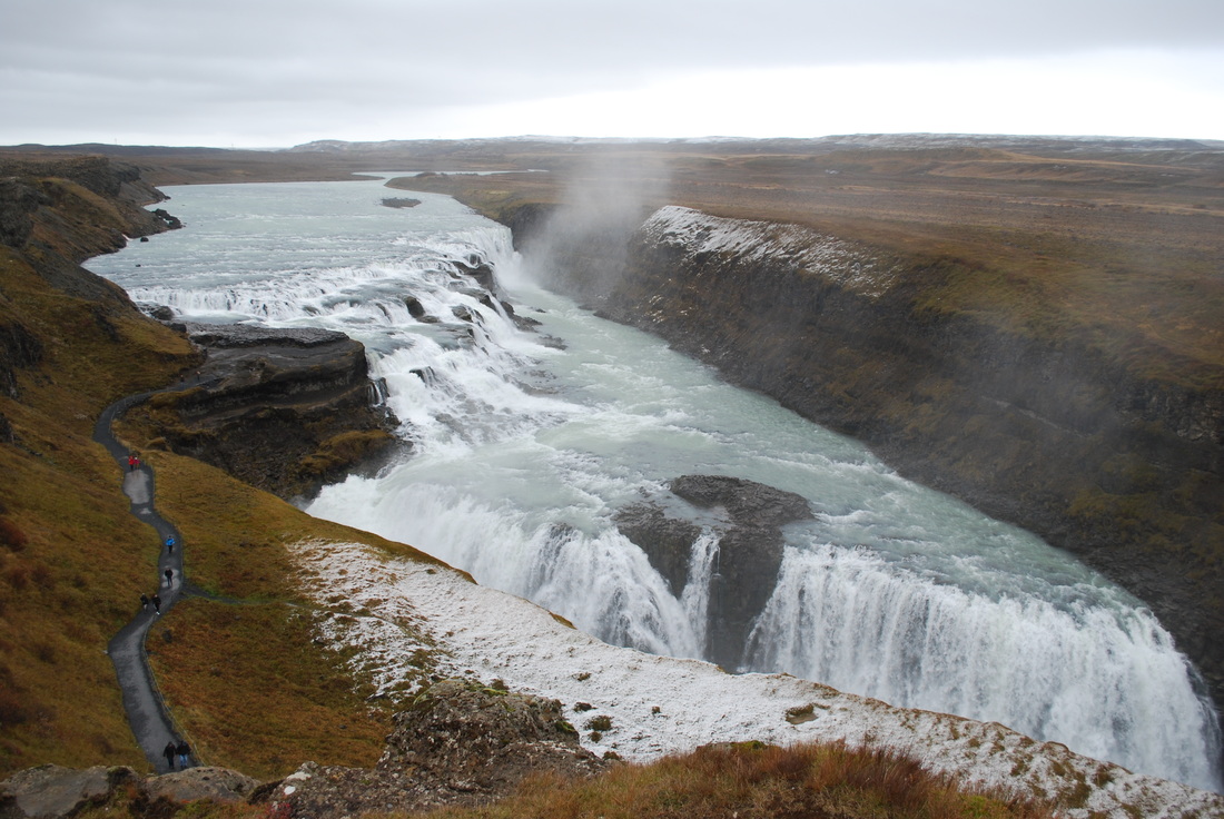
Moving on from Kerid, we travelled to the biggest waterfall in Iceland by volume of water. Gullfoss marks the edge of the highland shelf and the river Hvita flows at some 130 cumecs, as it plunges over a series of three steps down 70 metres. Up close and the sound of the falls is truly earth-shaking. Over the last 4,000 years the falls have retreated around 70 metres, leaving a steep gorge of recession, similar in shape to those at Thingvellir.
Moving on from Kerid, we travelled to the biggest waterfall in Iceland by volume of water. Gullfoss marks the edge of the highland shelf and the river Hvita flows at some 130 cumecs, as it plunges over a series of three steps down 70 metres. Up close and the sound of the falls is truly earth-shaking. Over the last 4,000 years the falls have retreated around 70 metres, leaving a steep gorge of recession, similar in shape to those at Thingvellir.
|
|
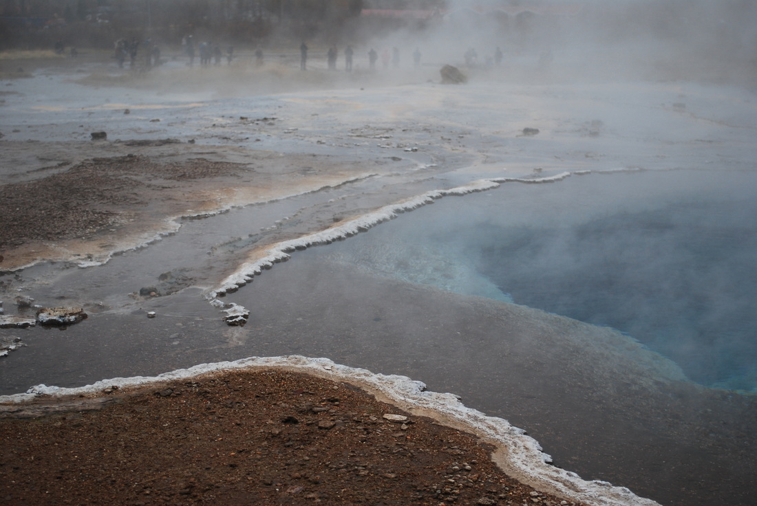
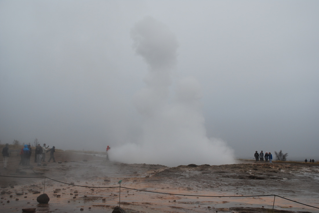
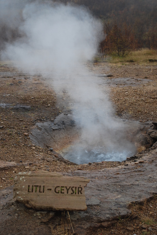
Our next stop is at what is known as the oldest tourist attraction in Iceland, that of Geysir. The world's original geyser was formed in the thirteenth century as earthquakes damaged the hot spring channels. Boiling water is superheated into steam and the pressure shoots water more than 70 metres up, when we visited Geysir was dormant, but the more active geyser known as Strokkur was in fine form. Strokkur gushed water up to 20 metres every five minutes and students were eager to get the best video footage of the water shooting skywards.
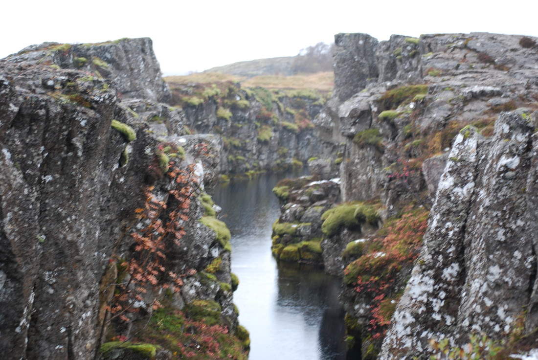
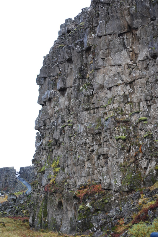
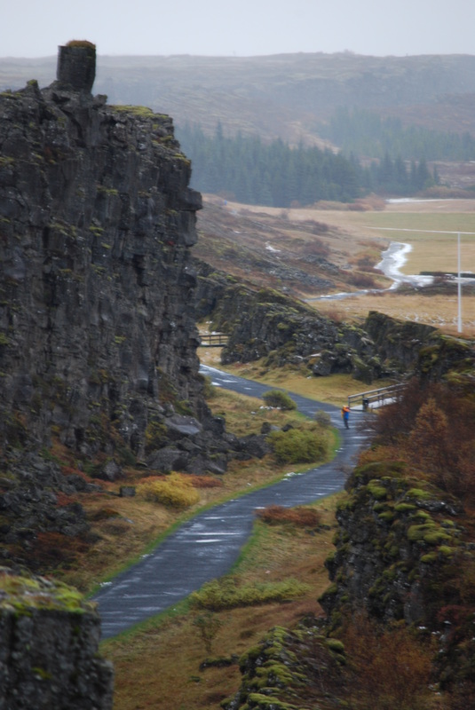
Our Icelandic guide was most excited about our next stop at Thingvellir. In AD930 Iceland's parliament or Althing was founded here and it is known nationally to be the heart of Iceland. Geographers are impressed by Thingvellir because it represents a divergent rift valley within the Mid-Atlantic Ridge, where the North American plate is pulling apart from the Eurasian plate. Thingvellir is the only place on earth where seafloor spreading can be seen up close and on land. Over the last 10, 000 years the valley has expanded to over 70 metres and the valley floor has dropped by around 40 metres.
Our study trip was almost over, so our last night was spent in Reykjavik eating at the contemporary Hamburger Factory and relaxing at the bowling alley.
Iceland is an amazing country to visit, the landscape is so diverse and each panorama reveals something quite different. Students were able to get up and close to many of the landforms we study in class and their geographical understanding has become much richer. Iceland was once a country reliant on fossil fuels, today hydroelectric power and geothermal provide a majority of all hot water and electricity for the 320, 000 people who live there. On the sunny days I could see the attraction of living in such a beautiful country, but as we boarded our bus back to the airport and the thermometer reads just two degrees celsius, I wondered what life here must be like in winter. Our driver Ludvik pointed out that you either survive or go mad.
This was an impressive study trip, students have taken away many photographs, memories and quite probably a huge quantity of volcanic rock, seeing as 30 per cent of all lava that has surfaced in the last 1000 years has surfaced in Iceland, I do not think anyone will mind!
Mrs Rawlings Smith
|
|
Gallery
Most photographs on this web page have been taken by E. Rawlings Smith and can be freely used for educational purposes under the Creative Commons Licence. The Iceland satellite image and that of the Northern Lights are sourced.


Some good links to YouTube videos with a focus on Iceland
|
|
|
|