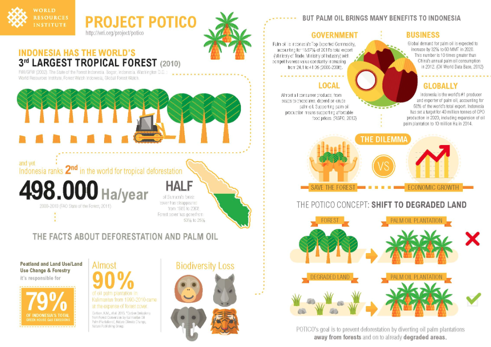
The World Resources Institute has produced a range of resources focused on the use, overuse and management of our global forests. There are some info graphics, as shown below, but the main draw of the website is the maps, charts and graphs.
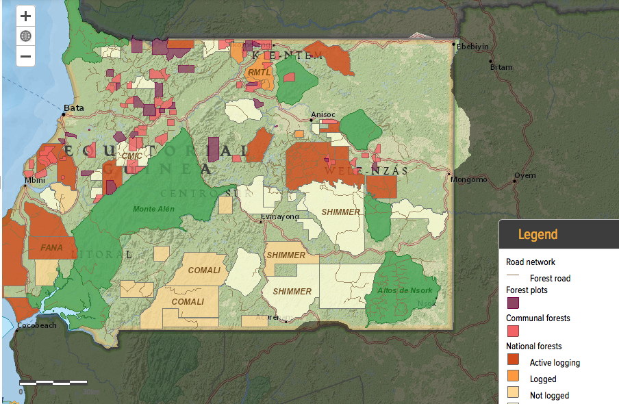
The first map I will be using in class is the Forest Atlas of Equatorial Guinea to show where there is active logging across the country. This information can be used to make decisions about priority areas for protection, or areas where ecological surveys need to take place. The area of biodiversity under threat can also be measured.
This database also has information on climate, energy, food, water, cities, governance and business. Explore it for yourself here.
 RSS Feed